Originally a rural outpost dominated by the Glenfield Farm and later the Hurlstone Agricultural High School. It served as a vital agricultural research and educational hub for Sydney's southwest throughout the 20th century.
Transitioning from a traditional 1970s family suburb into a high-density transit-oriented development hub with a diverse, multicultural population.
- Unrivaled rail connectivity for the Southwest region.
- Access to top-tier selective education at Hurlstone Agricultural High School.
- Significant capital growth potential from the Glenfield Precinct Plan.
- Larger block sizes in established areas compared to new estates.
- Proximity to the M5 and M7 motorways for vehicle commuters.
- Extensive flood zones near Bunbury Curran Creek affecting insurance and renovations.
- Ongoing construction noise and traffic from high-density apartment developments.
- Limited local shopping and dining options within the suburb itself.
- Potential for 'canyon effect' and loss of privacy as high-rises go up near the station.
- Aircraft noise potential as Western Sydney Airport operations scale up.
How this suburb feels day-to-day.
Dominant dwelling stock.
Typical entry to ceiling.
Glenfield is being repositioned by the NSW Government as a 'premier regional hub'. It is the gateway between the established south and the new Western Sydney Aerotropolis growth corridor.
$980k – $1.55m
$620k – $820k
12-month movement
Current asking rents
Prices are being buoyed by rezoning speculation and the scarcity of land in a suburb with such high rail utility.
Price comparison
Median price ÷ median income
Estimated rental yield
While more affordable than the inner ring, Glenfield has seen rapid price escalation, making it a 'stretch' suburb for many first-home buyers.
Lower = tighter market
Avg time on market
Annual rental increase
Commuting professionals, healthcare workers, and families prioritizing school catchments.
Strong capital growth prospects and low vacancy rates make it an attractive long-term hold, provided flood risks are managed.
- Glenfield State Significant Precinct rezoning.
- Direct rail link to the new Western Sydney Airport (via Aerotropolis line).
- Upgrades to the Hurlstone Agricultural High School precinct.
- Expansion of the Glenfield industrial and logistics hub nearby.
- Rising interest rates impacting highly leveraged buyers in the southwest.
- Over-supply of apartments in the immediate station precinct.
- Environmental constraints limiting development on the eastern fringe.
Glenfield is expected to outperform the wider Sydney market as the 'Aerotropolis effect' takes hold and the high-density precinct matures.
vs last 12 months
Relative comparison
Focus on properties with secure fencing and off-street parking, particularly near the station corridor.
The primary physical risk is flooding, while the primary financial risk is over-paying for land with restrictive rezoning overlays.
High risk near Bunbury Curran Creek; 1-in-100 year flood levels affect many residential lots.
Low risk, limited to the eastern river fringe.
Expect higher premiums for properties in the flood overlay; some insurers may refuse flood cover.
Flood Planning, Terrestrial Biodiversity
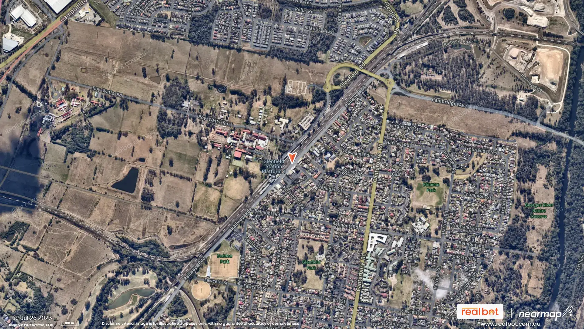
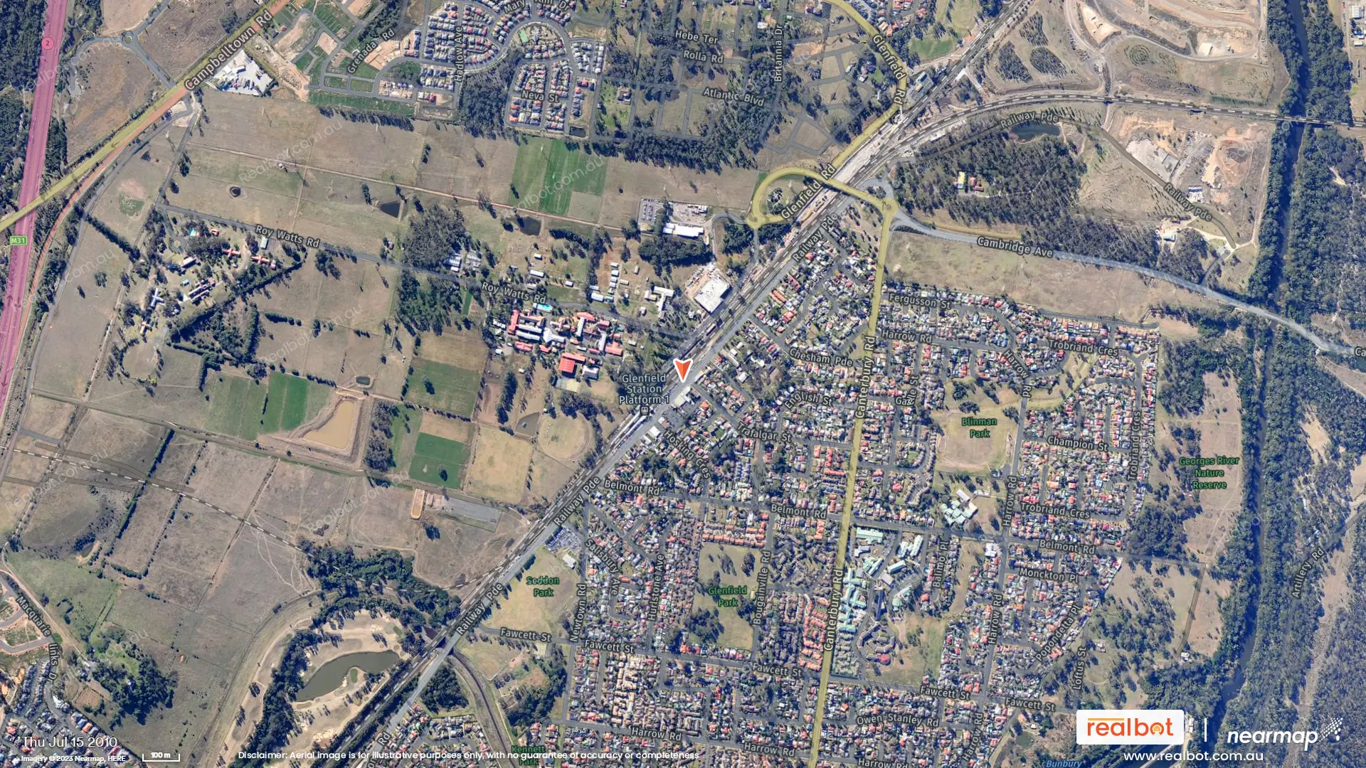
Station precinct and the former Hurlstone land parcels.
The Glenfield Precinct Plan allows for up to 7,000 new homes, fundamentally changing the suburb's density and skyline.
Exceptional rail interchange and motorway access.
Moderate; good local parks but lacks a high-end dining/retail strip.
Excellent access to Kennett Park and the Georges River Reserve.
Top-tier selective and solid local primary schools.
Close proximity to Campbelltown and Liverpool Public/Private hospitals.
A young, aspirational, and multicultural community with a high proportion of multi-generational households.
The young demographic supports long-term demand for schools and high-frequency transport.
The Glenfield Precinct Plan is the dominant force, introducing high-rise residential and new commercial spaces.
- Modernized station facilities and public plazas.
- Increased local job opportunities in the MU1 Mixed Use zones.
- Improved pedestrian and cycle links to the river.
- Increased traffic congestion during the 10-year build phase.
- Loss of 'village feel' in the station-adjacent streets.
- Shadowing impacts from new high-rise towers.
Residents value the 'best of both worlds' transport and school access, but express anxiety over the scale of new high-rise developments.
The trains are unbeatable; I can get to the city or Parramatta so easily, and my kids are in a great school catchment.
I love the potential here, but the constant roadworks and new apartments going up make it feel like a building site lately.
Being at the junction of three lines means I never wait more than 10 minutes for a train. It's a game changer for work.
It used to be so quiet here. Now they are building towers and the traffic on Railway Parade is a nightmare.
The parks near the river are lovely for the weekend, even if we have to drive to Casula for the big shops.
The rezoning is the big play here. Land value is going up, and the rental market is incredibly tight.
- Prioritize properties on the western side of the rail line to avoid the worst flood zones.
- Look for R4 zoned land if you have a 10-year investment horizon for potential developer buy-outs.
- Check the specific flight path maps for the Western Sydney Airport; Glenfield is on the periphery but noise may increase.
- Verify school catchment boundaries specifically for Glenwood Public vs Glenfield Public.
- Negotiate hard on properties with unmitigated flood risk or those directly adjacent to new high-rise sites.
- Is this property located within the 1-in-100 year flood planning area?
- What is the specific FSR (Floor Space Ratio) and height limit under the new Glenfield Precinct Plan?
- Are there any planned infrastructure works or road widenings affecting this street?
- How has the insurance premium changed for this property in the last two years?
- Is the property within the Hurlstone Agricultural High School optional catchment zone?
- What is the current status of the neighboring lots regarding development applications?
- Highlight the 'triple-line' rail access as the primary selling point.
- If your property is rezoned for high density, sell based on 'site value' rather than 'dwelling value'.
- Ensure any past flood mitigation work is documented and available for buyers.
- Target young professional families who are priced out of Edmondson Park.
- Professional styling is essential to compete with the modern townhouses entering the market.
Position the property as a 'strategic asset' in Sydney's fastest-growing corridor, emphasizing the rare combination of elite schooling and superior transit.
High-growth, high-demand rental market with significant rezoning upside.
Over-supply of apartments in the medium term and high insurance costs in flood areas.
- Target older houses on large blocks (600sqm+) with R4 zoning.
- Avoid the bottom of the hill near the creek to minimize insurance drag.
- Consider dual-occupancy (granny flats) to maximize yield while waiting for rezoning maturity.
- Monitor Campbelltown Council's local environmental plan (LEP) updates closely.
- Apply for properties within walking distance (under 1km) of the station to maximize the transport benefit.
- Check for NBN Fibre to the Premises (FTTP) if working from home.
- Ask about water billing if the property is an older house.
Unbeatable commute times and decent local parks.
Construction noise from new developments can be disruptive during the day.
- Keep the property well-maintained to attract professional commuters.
- Consider long-term leases to capitalize on the 1.1% vacancy rate.
- Ensure flood sensors or alarms are installed if in a low-lying area.
Standard NSW residential tenancy laws apply; ensure smoke alarms and pool fencing (if applicable) meet 2026 standards.
- The market is splitting between 'lifestyle buyers' and 'land-bankers'.
- Stock levels are low as owners wait for the full impact of the Precinct Plan.
- Buyers are increasingly wary of flood maps; transparency is key to closing deals.
The 'Gateway to the Aerotropolis' and 'The Selective School Catchment'.
Commuting professionals, multi-generational families, and strategic developers.
This report is for informational purposes only and does not constitute financial or legal advice. Data is based on 2024-2025 trends projected to 2026. Buyers should perform their own independent due diligence, particularly regarding flood risks and zoning changes.